


Recovering from a Natural Disaster

By Nearmap.
The surge in natural disasters across the nation has sparked a push to reinvent recovery tactics.
Over the last five years, natural disasters have come at a great cost. 2017 to 2021, $742.1 billion was spent on cleaning up after disasters according to Climate.gov. As these occurrences become more commonplace, it is time to optimize our recovery efforts.
Local government leaders play a big role in this. They carry the responsibility of ensuring their communities are prepared for events like these and managing the necessary procedures with emergency personnel to restore the community back to its former state, which includes re-establishing access to water, power, medical care and other community necessities.
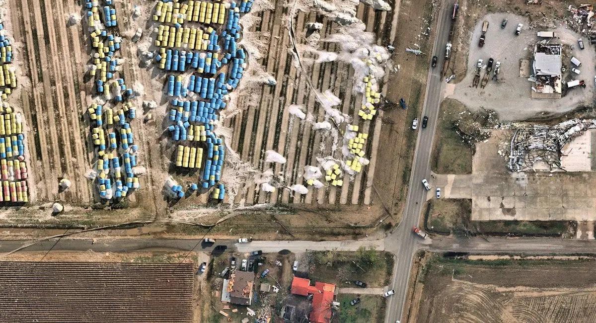
Although everyone wishes for a quick fix, these times require a cautious attitude. Technology is beginning to be of great help on this front. Aerial imagery allows government leaders to evaluate what work needs to be done, without subjecting themselves to hazardous conditions.
While speed is of upmost importance in recovery, caution cannot be overlooked. This is where aerial imagery can provide a safety measure by giving local government leaders access to truth on the ground without having to risk the potential dangers of being physically present in a catastrophic scene.
Community communication
Recovery efforts can be legacy building or breaking for local governments. Media interest in these efforts is continuous and heightens during an event’s anniversary. The attention given to a catastrophic event either highlights successes or showcases the failures of an administration’s ability to respond to a community in need. Being able to clearly communicate emergency response is key to relaying the efforts undertaken by local leaders to ensure speedy recovery.
During any disastrous event, many community functions are allocated toward reaction. This could involve government entities finding sufficient care for the injured, quarantining hazardous areas, or helping displaced residents find temporary shelter. Whatever the response, the public wants to know that their needs are being met in a timely manner. Being able to meet these needs, while also communicating long-term recovery goals, is easier said than done.
Road to recovery
Restoring an area that’s been impacted by a disaster culminates with citizens returning to their pre-event lives. Reaching the end of this path necessitates certain communal milestones, including the assessment of damages and indemnification of properties, restoration of services, and connecting residents with available assistance programs.
Community restoration happens in two phases: short- and long-term. Short-term efforts are focused on getting the community up and running to minimal operating standards as soon as possible. Meanwhile, long-term strategies are designed to restore areas that have been impacted by natural disasters back to their pre-event conditions.
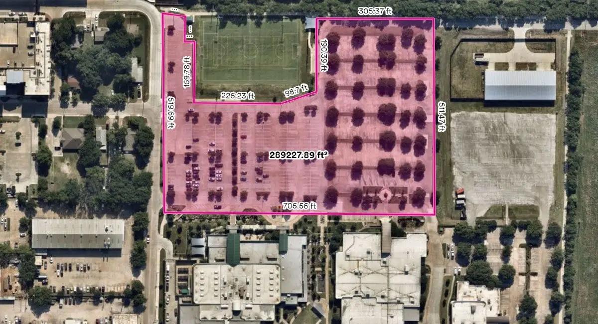
If the situation warrants, local governments may have to appeal to the state for assistance. Local officials will submit a request to the governor providing specific information about the event, its effects, and the type of assistance needed to get the community operational. Being able to accompany this request with high-resolution aerial imagery that clearly depicts the aftermath of an event can increase the approval odds.
Seeing how the community has been affected by a disaster is key to properly delegating resources. However, analyzing every nook and cranny of a catastrophic scene may be impossible due to safety issues or lack of resources. Using high-resolution post-event captures, local governments can accurately inspect their communities, readily assess the most impacted neighborhoods, and efficiently triage resources to areas in need of immediate assistance.
Aerial imagery for response and recovery
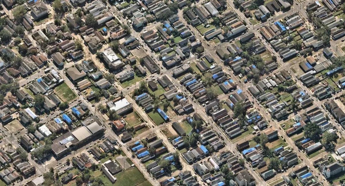
A picture is worth a thousand words, meaning that aerial imagery is capable of conveying a novel’s worth of narrative. Following a catastrophe, aerial captures provide an accurate assessment of an event’s impact — providing invaluable data which local governments can act on now and learn from later.
Using aerial imagery, local governments can quicken their understanding of an event and improve their recovery efforts. Each step of response and recovery can be enhanced through access to timely post-event imagery, including:
-
Evacuation measures
-
Situational awareness
-
Knowledge of overall impact
-
Recognition of community threat
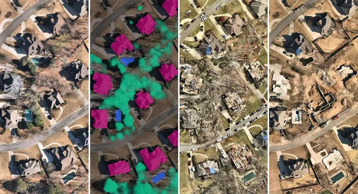
Every event has unique impacts, but the ability to rapidly review and understand those impacts from clear imagery can help predict future response efforts — which can enable local governments to drive down costs and risk using change detection and pre-event data. In many cases, aerial imagery can be used as a benchmark for measuring impact by comparing pre- and post-event captures. Further, aerial imagery can be complemented with 3D renderings, surface models, and AI layers to advance temporal change monitoring and provide risk analytics.
City of Grapevine, Texas
When the COVID-19 pandemic hit, it forced people around the country to shelter in place and social distance. Responding to this unprecedented event required local governments to set up testing centers capable of meeting the demand of a distressed community.
“We were able to use Nearmap to help create a comprehensive map of a potential community testing site at our local recreation center,” Betsi Chatham, GIS manager of the City of Grapevine
Chatham and her team were able to use Nearmap aerial imagery to determine exact measurements regarding the vehicle accommodation limit for potential testing lines. The imagery was also helpful in creating traffic routes and road closures that mitigated traffic stops and allowed continued access to nearby businesses. Chatham says, “Without Nearmap aerial imagery this process would have taken days to complete. With Nearmap, we were able to create detailed maps in a couple hours and make this a quick and easy process that we were able to execute on without a hitch.”
Aerial imagery is dynamic, adapting its insights to our changing world. Using visual data to guide decisions, local governments can effectively respond to and recover from disasters with remarkable efficiency. Over the course of her 30 years in government GIS work, Betsi Chatham has seen and experienced a number of trends and technologies. For her and her team, the biggest trend they see now is a greater reliance on aerial imagery. In an age where visuals are in higher demand, Chatham and her team have found Nearmap to be invaluable for their city.
Learn more about Nearmap in their RoofersCoffeeShop® Directory or visit nearmap.com.
Original article source: Nearmap.
Recommended For You

Why roofing contractors must understand lightning protection
Read More ...
Stop Sweating It: Dispelling 6 Myths About Household Humidity Problems
Read More ...
The Prelude to a Storm
Read More ...


Comments
Leave a Reply
Have an account? Login to leave a comment!
Sign In