")


Which Capital Cities Have the Most Leaves?

By Nearmap AI.
Nearmap AI’s revolutionary technology made it possible to aerially survey land and determine America’s 25 cities with the most leaf coverage.
You might be surprised to find that according to the CDC, there were an average of over 700 heat-related deaths annually from 2004-2018 in the United States. This is, in part, due to urban heat islands which are isolated areas with no tree coverage. These heat islands cause other major issues as well including higher daytime temperatures, poor air quality and poor water quality.
With residents becoming increasingly worried that urban heat islands are raising temperatures nationwide, the need for greener spaces to create more livable communities is increasingly important.
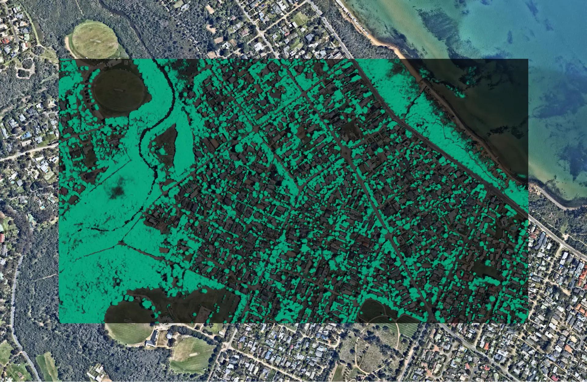
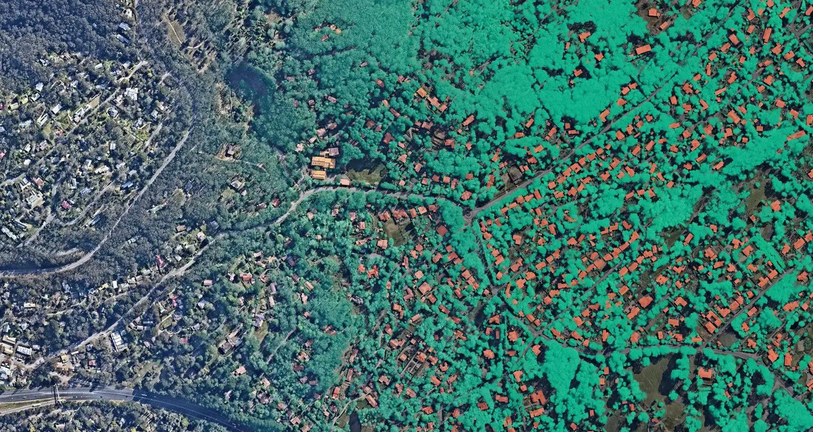
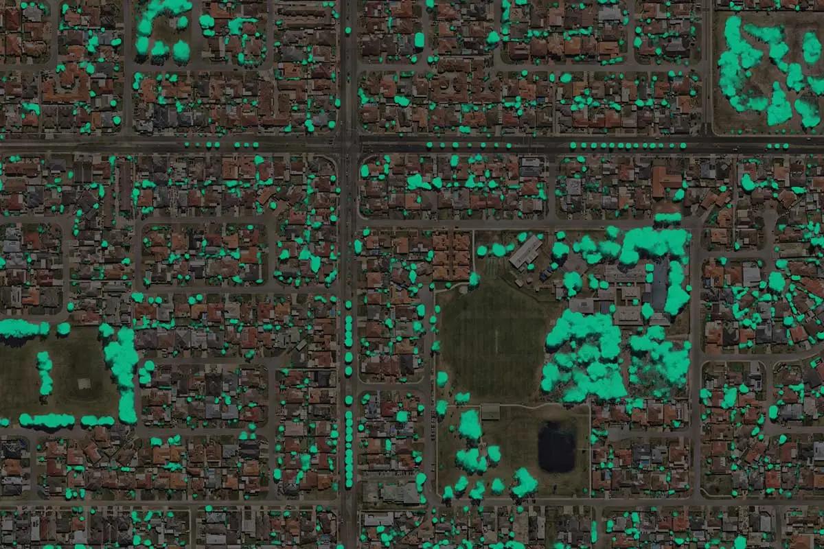
The Nearmap Artificial Intelligence (AI) team recently analyzed tree canopy coverage nationwide to determine America’s Top 25 Leafiest Capital Cities. Compiled through its proprietary aerial imagery technology — and coupled with location data from its Nearmap AI platform — this is the first and only research of its kind in the U.S. using a high-resolution data set to compare total residential tree coverage across capital cities for insurers, commercial construction companies. and governments. How green is your city?
America's leafiest capital cities
Informing the development of America’s Top 25 Leafiest Capital Cities required Nearmap to pull historical and current tree canopy high-resolution aerial imagery on residential areas covering more than 275 million inhabitants. We then harnessed Nearmap AI machine-learning capabilities to identify and analyze residential tree cover density and changes in capital cities throughout the United States.
The report identified the top 25 leafiest capital cities and their percentage of total residential tree coverage, with the top five being:
- Charleston, West Virginia (74.7%)
- Tallahassee, Florida (56.1%)
- Little Rock, Arkansas (54.9%)
- Raleigh, North Carolina (54.7%)
- Nashville, Tennessee (53.5%)
The complete top 25 leafiest capital cities includes:
Capital City | State | Percentage of Total Residential Tree Coverage
- Charleston | West Virginia | 74.7%
- Tallahassee | Florida | 56.1%
- Little Rock | Arkansas | 54.9%
- Raleigh | North Carolina | 54.7%
- Nashville | Tennesse | 53.5%
- Atlanta | Georgia | 53.1%
- Annapolis | Maryland | 51.0%
- Concord | New Hampshire | 49.2%
- Jackson | Mississippi | 47.5%
- Augusta | Maine | 46.3%
- Jefferson City | Missouri | 43.3%
- Austin | Texas | 43.2%
- Olympia | Washington | 42.9%
- Columbia | South Carolina | 40.1%
- Richmond | Virginia | 39.9%
- Albany | New York | 39.1%
- Montgomery | Alabama | 34.9%
- Baton Rouge | Lousiana | 34.1%
- St. Paul | Minnesota | 33.2%
- Des Moines | Iowa | 31.4%
- Topeka | Kansas | 30.6%
- Indianapolis | Indiana | 29.5%
- Springfield | Illinois | 27.7%
- Frankfort | Kentucky | 26.3%
- Columbus | Ohio | 26.1%
“Data of this detail and consistency has never been possible on such a national scale before. Our Nearmap AI platform uses machine learning to turn high-resolution aerial imagery into information and insights, creating a proprietary dataset that our customers use as a source of truth to make our communities more sustainable, resilient, safe and appealing to residents. The fact that it can be used to make comparisons between current and historical captures is critical. It means that we can help not just to map cities, but actively monitor their change, and to help them quantitatively assess the impact of things like a change in policy, a natural disaster or a shifting climate.”
-Dr. Michael Bewley, vice president of AI and computer vision at Nearmap
Why leafiness matters
A connection to nature in an urban environment is paramount to the physical, mental, and social health of city residents. Studies show that parks and green spaces have positive impacts on anxiety and depression. Further, these areas facilitate communal interaction and promote healthy activities (e.g., cardio and sporting events).
Tony Agresta, executive vice president and general manager of North America at Nearmap, said:
“The volume of tree cover can have a significant impact on public health and safety, from preventing overheating, improving environmental health, and mental and physical health benefits. Beyond that, the insights gleaned from this data can be used by insurers, construction companies and local governments to create tangible change in their communities, in addition to tracking progress in the creation of greener cities, reducing natural disaster risk and progressing urban development.”
Nearmap ai coverage
The fifth and latest generation of Nearmap AI is enabled by a deeper learning model trained on a much larger data set. The product has grown to an automated map of 78 layers (up from 49 layers in the previous version), and more than 500 insights per parcel. View the full list of Nearmap AI packs and layers.
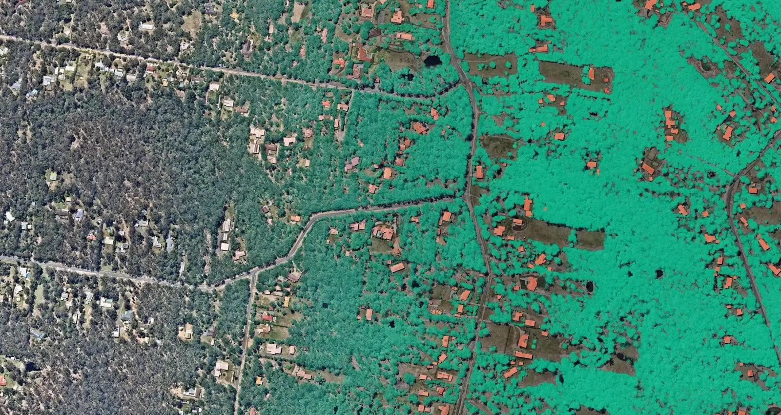
Among the new layers are “leaf-off vegetation” (which can identify trees without leaves, even during the Summer season) and “vegetation debris” (which identifies broken and damaged vegetation — like dead wood lying on the floor or trees impacted by wind). Coupled with the near infrared capture capabilities of the new HyperCamera 3 system, Nearmap is continuing to evolve its offering in vegetation management, extending its use cases to vegetation health and wildfire risk management.
Nearmap surveys more than 100 million locations in the United States up to three times per year, making it easy for local governments, insurers, and construction companies to continuously see the AI insights needed to track their performance against goals, identify areas of concern and measure community impact.
Original article source: Nearmap
Learn more about Nearmap in their Coffee Shop Directory or visit www.nearmap.com.
Recommended For You

Transforming roofing projects with AlphaGuard FC LO
Read More ...
New Streak Resist™ Technology Available from Malarkey Roofing Products
Read More ...
Installing Starlink on a metal roof: Key things homeowners should consider
Read More ...


Comments
Leave a Reply
Have an account? Login to leave a comment!
Sign In