Aerial Imagery is Essential to Maximizing Urban Sustainability

By Tony Agresta, Nearmap.
There are a multitude of benefits to utilizing aerial imagery for capturing accurate representations of our population and environments.
The first known cameras created for aerial imagery were designed to be used in World War I by the British Royal Air Force in an attempt for pilots to gather intel on German military forces. Even back in 1915, the technology was a brilliant breakthrough in the possibilities of using imagery to better view large expanses of land and populations.
Fastforward over a hundred years to today, and aerial imagery and technology has advanced in ways never imagined before. Camera-enabled drones are both just another common toy sold at department stores and a highly advanced technology used by the military to undergo high-risk missions. The technology can also be used for advancing our knowledge of climate change and how to better aid efforts to heal and preserve our environment.
Nearmap is using aerial imagery to aid environmental sustainability efforts in projects from city planning to construction projects and assessing property damage from natural disasters. In this article, we will discuss the ways contractors and professionals can utilize Nearmap’s services to maximize their project impact.
Maximizing environmental sustainability in commercial construction projects
It may seem implausible that the same technological concepts that aided armies in battle strategies are now being used to help combat the effects of climate change and ensure stable construction and infrastructure development, but they are. Aerial imagery and location technologies have made such strides that they now have applications to support efforts aimed at ensuring natural resources are safeguarded, and emissions are reduced throughout the construction and development process.
When considering the sheer output that’s required to survey a new construction project, it’s important not to overlook the environmental cost required to make that happen. The required personnel to preliminarily assess a site can be costly, and the carbon emissions required by personnel travel can be damaging to the environment. By substituting a “boots on the ground” model with highly precise aerial imagery, leaders can reduce the amount of travel needed to sites and cut down on their carbon footprint.
Given that many of the results of climate change are slow and occur over a long period of time, it can be difficult to accurately measure the impact of environmental deterioration. But new advancements now allow for flying drones carrying highly technical cameras capable of securing detailed images reflecting changes in land over time.
Digital aerial photography solutions can aid leaders in terms of insurance as well, in their outlining of valuable insights into areas impacted by natural disasters needed to ensure compliance with property laws and illustrate whether redevelopment is needed.
Whether due to severe droughts or flooding, erosion or landslides, aerial imagery technology can be leveraged to identify areas most impacted by climate change. This can aid businesses and property owners in creating accurate and comprehensive response plans for natural disasters.
Aerial imagery as a tool to assess and sustain continued growth of cities
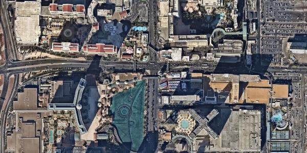
As a case example, consider Las Vegas — a bustling metropolis known around the world. But do people really know what it takes to keep this entertainment hub growing? As the fourth largest city in Nevada, development has triggered extensive innovation and a sharp uptick in population. In fact, Las Vegas has grown 33.4% since 2000.
It’s been in part through the use of aerial imagery technology and geospatial content that Las Vegas has been able to better identify existing areas in need of infrastructure updates and pinpoint ideal plots of land for continued development.
Meanwhile, Chicago has remained the most sought-after city for corporate investment for the past nine years. In 2022, Chicago saw an all-time record number of new and expanding corporate locations. With 59 million square feet of expansion or new space being accounted for, Chicago surpassed all other regions in the country by way of development.
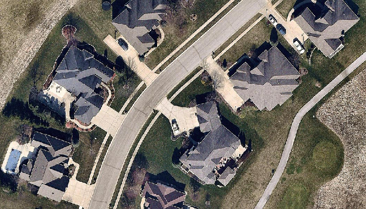
To maintain standing as an attractive location for urbanization, aerial imagery can help simplify the location process and ensure contractors are identifying areas they can mold in their vision.
Preparing, reacting and rebuilding in the wake of disaster with aerial imagery
The world is seeing an increase in climate disasters, with 20 weather-related disasters creating $145 billion in total combined damages overall for 2021. These increases necessitate a new way of planning and reacting to the impact of these events.
Aerial imagery and mapping technology can provide cities and states with the insights they need to effectively identify and assess areas of vulnerability prior to a weather catastrophe occurring, helping create a viable plan of action and rebuild in the wake of geographically altering events incidents.
A timely example of the way aerial imagery was used to assess damage from a natural disaster can be found in the wake of Hurricane Ian. The highly detailed images captured after its devastation allowed insurers, municipalities and construction companies to get detailed insights sooner by clearly mapping out the path of destruction and where resources must be allocated by local governments to assist in rebuilding.
When compared to images taken prior to Hurricane Ian, residents and local governments gained a clear understanding of the extent of the destruction by showing what impacted areas looked like pre- and post-Ian. This imagery ensured that states affected by the hurricane were able to quickly and efficiently identify expanses that required the most immediate attention.
Leaders considering aerial imagery as a solution
Aerial imagery has come a long way since that first camera on a kite took flight. The technological advancements are evident in the way aerial imagery is being used to combat the effects of climate change, leveraged by cities to aid in their continued development and expansion and integrated by local governments to aid in disaster response plans and relief efforts. As this technology becomes more sophisticated, the potential for its implementation is limitless.
Learn more about Nearmap in their Coffee Shop Directory or visit nearmap.com.
Original article source: Nearmap


Comments
Leave a Reply
Have an account? Login to leave a comment!
Sign In